Craving a small-city main street where you can grab coffee, stroll to dinner, and be at a park concert by sunset? In San Carlos, that is a typical evening. You get a lively downtown, easy access to green space, and a neighborhood feel that is hard to fake. In this guide, you will learn how Laurel Street works day to day, where locals spend weekends outside, what kinds of homes you will find, and the basics of commuting and schools. Let’s dive in.
Downtown Laurel Street at a glance
Laurel Street is the heart of San Carlos. It is compact, lined with independent shops, and full of outdoor dining. Many blocks feel set up for daily errands as much as a night out, which is part of the appeal if you want a car-light lifestyle.
A compact, walkable main street
You will find short blocks, a steady mix of cafes and restaurants, and small services that make life simple. Weeknights are relaxed, while weekends and event days feel festive. The city has leaned into this pedestrian energy with ongoing planning and programming.
Permanent pedestrian upgrades
The City Council has adopted a long-term vision for a more pedestrian-friendly core. The 700 block of Laurel Street is now permanently closed to vehicles by ordinance, and the city’s adopted Downtown Specific Plan prioritizes plazas, refreshed streetscapes, and a redesigned Harrington and 700-block plaza area. Improvements are planned in phases, and timing will depend on funding and scheduling.
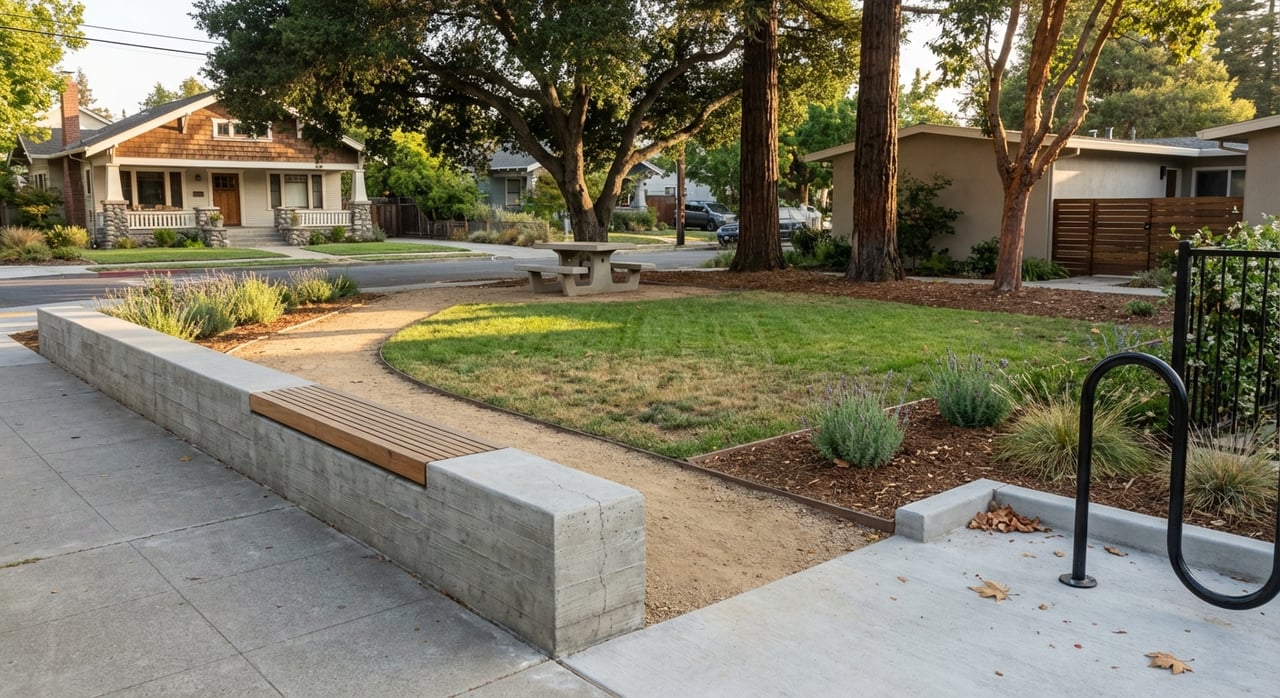
Parks, trails, and weekend fun
Burton Park is the city’s central green and a short walk from many downtown-adjacent blocks. It hosts summer concerts, movie nights, and Hometown Days on a lawn that can handle a crowd. Families use the playgrounds and courts all week, and the amphitheater brings neighbors together. You can explore the city’s park network and programming on the Parks & Recreation page.
Neighborhood parks and nearby preserves
Beyond Burton Park, you will find neighborhood spots like Highlands Park, Crestview Park, Laureola Park, and City Hall Park. In the western hills, local open-space parcels and trails offer quick nature breaks. For longer hikes and spring wildflowers, many residents drive a few minutes to nearby preserves such as Edgewood Park and Pulgas Ridge, highlighted in this regional trail overview.
Unique local attractions
At the San Carlos Airport, the Hiller Aviation Museum is a family favorite with interactive exhibits and special events. It is a distinctive weekend outing and a point of pride for many locals.
Events and the community rhythm
From spring into early fall, Laurel Street hosts Hot Harvest Nights, a weekly evening farmers market that brings live energy to downtown. See the latest dates on the Hot Harvest Nights listing. In the fall, the San Carlos Art & Wine Faire takes over Laurel for two days and draws regional visitors; the operator’s page shares event details for planning your visit through the Art & Wine Faire listing.
Housing and neighborhoods
San Carlos is compact, roughly 5 to 6 square miles, with two broad living patterns. Near downtown, you will see more condos and smaller bungalows on modest lots, often around 5,000 square feet. In the western and southern hills, homes sit on larger lots with more privacy and views.
What you will find by area
- Downtown and flats: multi-family buildings, condos, Craftsman cottages, and mid-century ranch homes, plus pockets of newer infill and remodels near transit.
- Hillside neighborhoods: larger mid-century and newer homes, more indoor-outdoor space, and quieter streets.
Common neighborhood names you will hear for orientation include Howard Park, White Oaks/El Sereno, Clearfield Park, Cordes, Crestview, and Beverly Terrace. If you prize walkability, focus on Howard Park, Clearfield Park, and downtown-adjacent blocks. If you want more space and views, explore the western hillside areas like Crestview and Beverly Terrace.
Walkability: block-by-block reality
San Carlos has highly walkable pockets around Laurel Street and more car-dependent hills. That mix is normal here. Walk Score data shows that areas near Howard Park and Clearfield Park rate well for daily errands, while the hills are less walkable. For context, see a representative Walk Score view near downtown.
Commute, schools, and daily logistics
The San Carlos Caltrain station at 599 El Camino Real sits right by downtown and is the primary rail link up and down the Peninsula. Service levels vary by train type, so check schedules for the trips that matter to you. For station background and service context, see the San Carlos station overview.
Driving is straightforward in terms of access. San Carlos sits between US-101 and I-280 with El Camino Real running through town. The distance to San Francisco is in the mid-20-mile range depending on route, as shown in this San Carlos to San Francisco distance check. Traffic at peak times can be heavy, so proximity to Caltrain or 101 is a common decision point.
For schools, San Carlos operates its own TK–8 district, and high school assignment typically falls within Sequoia Union High School District based on address. Always verify the assigned schools for any specific property. You can review district context through the San Carlos School District overview.
Parking and downtown access
With parts of Laurel Street pedestrianized, the city’s plan includes a parking management approach and event-day strategies like shuttles and temporary lots. If you live downtown, expect to use nearby off-street lots or curb parking rather than long private driveways. The Downtown Specific Plan outlines these policies.
Is San Carlos a fit for you?
If you want a true main street, frequent community events, and parks you can reach in a few minutes, San Carlos delivers. If you prefer more space and a quieter, leafy setting, the hills give you room and views in exchange for fewer walkable errands. Near the airport on the east side, you will also find unique access to museum programming along with the practical reality of occasional flight activity. The right fit comes down to how you weigh walkability, space, and commute.
Ready to explore San Carlos and see which neighborhood matches your everyday life? Schedule your free consultation with Stacey Davis to compare options and plan your next move.
FAQs
Is San Carlos walkable if I want to run most errands on foot?
- It depends on the block, with downtown and adjacent areas like Howard Park and Clearfield Park rating highly for walkability, while the western hills are more car-dependent.
What are the major community events in downtown San Carlos?
- Hot Harvest Nights runs weekly in summer on Laurel Street, and the San Carlos Art & Wine Faire is a large two-day fall festival that draws regional visitors.
How do downtown and hillside homes in San Carlos differ?
- Downtown and the flats offer condos and smaller bungalows near shops and Caltrain, while the hills feature larger lots, mid-century and newer homes, quieter streets, and views.
How practical is the commute from San Carlos to San Francisco?
- Caltrain offers a direct rail option from the downtown station, and driving distance is in the mid-20-mile range, though peak traffic can add time based on route.
What should I know about parking if I live near Laurel Street?
- With a pedestrian-focused core, expect to rely on nearby public lots or curb parking; the city manages parking and event-day access through its downtown plan.